Raising Awareness of Early Prehistory
In order to flag up the results of early prehistoric research to developers, heritage managers and others involved in the planning process, the right information needs to reach the sources of data they would normally consult, especially the relevant Historic Environment Records (HERs).
This applies both to new projects and existing collections, and includes archaeology (stone tools), deposits and palaeoenvironmental sites. We therefore commissioned several projects that will improve the accessibility of early prehistoric research and enhance its representation on HERs and other databases. A review of this work with guidance on best practice has been published as an Historic England Research Report.

Lost Landscapes of the Palaeolithic
Our knowledge of the Lower and Middle Palaeolithic periods in Britain has been transformed by recent research and reporting initiatives, particularly ten years of work funded by the Aggregates Levy Sustainability Fund (ALSF), which closed in 2011.
We have funded a new synthetic volume, Lost Landscapes of the Palaeolithic, by Oxford Archaeology, which critically assesses the value of this work and makes the results more accessible, especially to heritage professionals who are not Palaeolithic specialists. It is available as a free digital download.
The project has also updated the artefact database produced in the 1990s for The English Rivers Palaeolithic Survey (TERPS), which is available via the Archaeology Data Service (ADS).
HER enhancement projects
Records relating to known and potential Palaeolithic and Mesolithic sites and find-spots were checked and enhanced in a number of areas:
- In Worcestershire Palaeolithic archaeology was poorly represented on the HER and therefore poorly protected through the planning process. The project aimed to take existing specialist information, update it based on recent evidence and new interpretations, and place it within the HER in such a way that it can be interpreted and used by non-specialists. A report on the project has been published in Internet Archaeology.
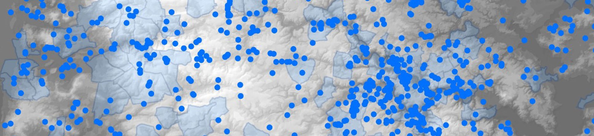
- In South Yorkshire there is high potential for the survival of Upper Palaeolithic and Mesolithic remains in the low-lying, seasonally waterlogged areas on the eastern side of the county and the upland areas on the county’s western side. Threats to their condition and survival from commercial development and extensive peat erosion are very real. The project collated information from various data sets and produced GIS-based maps highlighting areas of potential.
Read the report: Enhancing the Palaeolithic and Mesolithic records of the South Yorkshire SMR Suffolk has a large number of Palaeolithic and Mesolithic finds including some of the most important sites in Europe, such as Pakefield and Beeches Pit. The project enhanced HER records for these periods by adding missing information and updating protocols for dating and finds identification. The dataset is now publicly available on the Suffolk HER, along with new Palaeolithic and Mesolithic pages on the Suffolk Heritage Explorer website.
- The West Yorkshire project aimed to enhance existing records, examine local museum holdings of Mesolithic and possible Palaeolithic material, and identify areas with high potential for providing significant palaeoenvironmental data. This will provide a more reliable guide to assessing the significance of West Yorkshire’s early prehistoric resources when responding to future planning and management consultations.
Read the report: Revised Report on the Enhancement of the West Yorkshire Historic Environment Record for the Palaeolithic and Mesolithic Periods - In Essex a predictive model was created by which the potential for survival of Palaeolithic archaeology within any given area of the county can be quickly assessed, and its nature and significance understood. The result is a map-based dataset that can inform local authorities of the potential impact of development, and demonstrates how a GIS resource can be used by non-specialists to inform understanding of the Palaeolithic resource.
Read the report: Managing the Essex Pleistocene Project - In Norfolk over 2,250 existing records relating to early prehistoric sites and finds were enhanced, while new information from museum collections, the John Wymer archive and the excavations at Happisburgh was integrated. Planning guidance was developed to ensure early prehistoric remains are adequately protected from the threats posed by development, mineral extraction and coastal erosion. Outreach from the project aims to raise public awareness of Norfolk’s internationally significant early prehistoric past.
Read the report: Enhancement of Early Prehistoric Information Within the Norfolk Historic Environment Record
Palaeolithic and Mesolithic lithic artefact database (PaMELA)
This project, carried out by Wessex Archaeology, involved the development of an online database (nicknamed Pamela) of finds from the Upper Palaeolithic and Mesolithic periods, based on the archive of the late Roger Jacobi. The results are available via the Archaeology Data Service.


