Fishing for Heritage
A project to better understand undersea obstructions known as ‘fishermen’s fasteners’ off the coast of Sussex.
Sussex Inshore Fishing and Conservation Authority (IFCA) carried out a project for Historic England to investigate the archaeological potential of features on the seabed found by commercial fishermen.
The project looked at historic records of ‘fishermen’s fasteners’ – places where fishermen have snagged their fishing gear – alongside recent data about the seabed.
It also examined the seabed using equipment employed by Sussex IFCA: the purpose was to establish whether its methods, designed to better understand seabed habitats, could also be used for archaeological purposes. Working with fishermen, several underwater heritage sites were investigated, including one site that proved to be a crashed US military aircraft.
Setting out the study area
Sussex IFCA is one of ten IFCAs around the coast of England that are responsible for managing both commercial and recreational inshore fisheries and protecting the marine environment from the impacts of unsustainable fishing activities. IFCAs are statutory local government bodies with powers and duties described within the Marine and Coastal Access Act 2009.
The District of each Authority extends six nautical miles seaward from the coastal local authorities represented in each IFCA. Sussex IFCA’s District lies on the south coast between Dungeness and Chichester Harbour. ‘Features of archaeological or historic interest’ are included within the definition of the marine environment for which IFCAs are responsible.

Exploring a complex relationship
The overlap between fishing and heritage is complex. The history of fishing – one of humanity’s oldest activities – is part of our heritage, contributing to the structure, character and vibrancy of coastal communities.
Fishing is also a very hazardous occupation and the wrecks of many fishing vessels lie on the seabed – especially from the period of the two World Wars when fishing boats and their crews were used to protect Allied shipping from mines and attacks, suffering many casualties.
Many fishing methods rely on towing or deploying some form of net or other gear in the water column or down to the seabed and subsequently recovering the gear and the catch it contains. In so doing, there is a danger that the gear will snag on features of the seabed such as rock outcrops, but also on shipwrecks and other heritage assets. When the equipment snags there is a strong chance that gear will be damaged and occasionally lost. In fact, snagging can endanger vessels and crew, and some fishing boats have foundered – with fatalities – from snagging gear, even in recent years.
However, the same features that cause a risk of snagging are also attractive habitats for marine life, and fish often gather around them for protection or to feed. Hence fishermen target these features, aiming to work their gear as close as possible to improve their catches, yet not so close that they snag.
Historically, fishermen recorded information about their ‘marks’ in notebooks and on paper charts. They continue to do so today, but with the assistance of GPS and digital navigation tools known as plotters.
Typically, this information is not freely shared because it can be commercially valuable to competing fishermen, but there are instances where snags have been added to published charts – such as the series of Kingfisher Charts for fishermen issued between the 1960s and the 1990s.
Several of the most important historic wrecks that are designated under the Protection of Wrecks Act 1973 were first discovered because fishermen snagged their gear on them, with divers then investigating the snag to find out what caused it.
Consequently, gear snags are a potentially important source of archaeological information – as too are the artefacts recovered by fishermen with their catches. Of course, such snags and recoveries also represent impacts to archaeological material on the seabed, which can be damaged and destabilised by fishing activity. It is important for archaeologists to respond to snags and recoveries not only to understand more about the remains of the past, but also to encourage fishermen to avoid places where fishing might cause damage.
Recording fishermen's fastners
The first national database of marine archaeological sites was established for England in the early 1990s by Historic England’s predecessor, the Royal Commission on the Historical Monuments of England. Information about gear snags on the Kingfisher Charts was incorporated wholesale into the new record as ‘Fishermen’s Fasteners’ because they potentially represented archaeological sites. Some local authorities also recorded fishermen’s fasteners, and this evidence was also transferred to the national record. Consequently, the national database – maintained by Historic England – contains almost 7,000 records of fishermen’s fasteners.
However, nothing more is known about these places other than fishermen have recorded a snag at some point in the past. Also, methods of position-fixing at sea have – until recent years – been quite poor, especially for possibly small features encountered by fishing gear at a distance from the vessel. It is difficult, therefore, to gauge how much archaeological weight to place on these records: they could prove to indicate highly significant historic wrecks, or they might just identify small rock outcrops or other natural topographic features.
There are so many fasteners recorded – with possibly imprecise positions – that diving on each of the recorded locations is not a viable approach.
Working with fishermen
Sussex IFCA’s project addressed the conundrum presented by fishermen’s fasteners, working within the commercial fishing sector using existing capabilities and with fishermen themselves to better understand the implications of fasteners for marine management.
Several important technical developments have occurred in how we are able to investigate the seabed since the national marine record was initiated. These include precise position-fixing using GPS, detailed topographic surveys using multibeam echosounders, and imaging using digital underwater cameras. These tools – and the data they generate– are commonly used in a variety of marine sectors including fishing, as well as by archaeologists.
The project centred on how Sussex IFCA could use these methods and data to better understand fishermen’s fasteners. To help design and implement the project, Sussex IFCA employed Fjordr Limited, a small consultancy specialising in marine and coastal archaeology.
Comparing data
Part of the project was desk-based. Historic England provided data from its marine database so that fasteners could be compared to other types of record, including known shipwrecks. The fastener data was also considered alongside information about the type of seabed and information about fishing activity, to see if the fasteners were associated with rocky areas (which might imply a natural origin) or if fishing activity was still taking place in their vicinity (which might confirm the presence and position of a feature).
The positions of fasteners were also compared with regional seabed topography data collected in recent years by the Civil Hydrography Programme, to see if the fasteners could be correlated with topographic features. As well as providing feedback on the character of fasteners, this desk-based work was used to prioritise a series of fasteners that could be examined through fieldwork.
Surveying the seabed
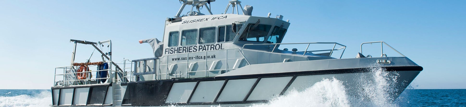
Fieldwork took two main forms: seabed survey using multibeam echosounders; and imaging the seabed using cameras deployed from the surface . Different methods of each were tried, both from Sussex IFCA’s vessel Watchful and from hired fishing vessels. These methods are used by IFCAs to help provide the scientific basis for their management of fisheries in the district: Watchful is used both to conduct research activities and to support the enforcement of fisheries management measures.
Multibeam echosounders are now relatively common place. Rather than sending out a single beam of sound to bounce off the seabed and calculate its depth, a fan of beams spreads out on either side to build up a picture of the swathe of seabed under the vessel. Expensive survey-grade equipment can generate very detailed images of features such as wrecks, but smaller inshore fishing vessels use less costly ‘fish finders’ that work in a similar way to show the seabed together with fish in the water column. Although working at a lower resolution, the echosounders we used aboard Watchful and the hired fishing vessels provided very useful data on the extent of fasteners that were represented simply as a ‘dot’ in the existing record, and we were able to use this data to direct the camera systems across the seabed.
Sussex IFCA was also able to deploy a survey-grade multibeam over a couple of fasteners in conjunction with another project. This aspect of the project demonstrated the archaeological value of seabed topography data acquired by IFCAs and fishermen during their work, both in confirming whether there is a feature present at the location where a fastener is recorded, and in providing preliminary information about extent, form and character that indicates whether the feature might be of archaeological interest.
Acquiring images of the seabed using a camera is used in fisheries science to characterise the type of seabed habitat – which is a product of the seabed sediments and the plant and animal species that live there. Understanding the extent and nature of marine habitats and the associated marine fauna and flora is critical to the success of future marine fisheries and conservation management, so IFCAs are involved in mapping and monitoring the habitats within their districts using underwater cameras. Our question was whether we could use the same equipment to obtain images of fasteners?
Two types of camera system were deployed : a relatively small system comprising a forward-facing video camera mounted within a stainless steel ‘sled’ that is towed across the seabed; and a large system with both a video camera and a still camera, plus lights, which is lowered onto the seabed to obtain high-resolution downward-facing images. Both systems relay a video picture to the surface, which can be monitored by the crew and recorded. The sled could be deployed both from Watchful and hired fishing vessels, whilst the downward facing camera requires quite a powerful winch arm over the side and could only be deployed from Watchful.
Again, the project demonstrated that with the equipment available it was possible to obtain images of features on the seabed that were sufficient to identify their character, including if they were of archaeological interest or not. The relative ease with which the sled could be deployed was an advantage, even if the resulting images were not as high resolution as the bigger drop-camera.
A further important benefit of working on the hired fishing vessels – a sea angling charter boat and an inshore fishing vessel – was the opportunity to work directly with fishermen.
As well as the fasteners we targeted from our existing data, the fishermen shared information about other marks they knew about, and which we were able to examine.
Discovering wrecks and submerged landscapes
To test the methodologies, a variety of targets were selected including some features and wrecks that were already known and confirmed, some features whose presence was fairly certain but whose character was not known, and some features that had only been noted as ‘marks’.
Among the wrecks and features that were investigated, we found a previously unrecorded metal wreck with a cargo of stone and unexpectedly relocated the crash site of a US bomber that had been visited by divers in the 1970s-80s but whose position was uncertain.
Among the marks shared by fishermen we examined several localised and prominent rock outcrops that are natural in origin, but which might – as underwater tors – bear further examination as former features of now-submerged prehistoric landscapes fringing the Sussex coast.
Although the periods of fieldwork were quite short – just a matter of days – they provided extremely useful feedback about the practicalities of investigating very localised targets from regular workboats. Trying to tow a video sled across the seabed so that it intercepts a relatively small feature in such a way that it will provide useful images is a tall order, bearing in mind that the underwater visibility may only be a few metres at best, and that the tidal current, wind and sea state will act on the boat, the sled and its cable in complex ways.
In each case this required remarkable skill by the skippers and good teamwork by the IFCA crew and onboard archaeologist. The project bodes well for further collaboration between archaeologists, IFCAs and fishermen to improve our understanding and management of the marine historic environment.
About the authors

Antony Firth
Director of Fjordr Limited
Antony started his career in marine archaeology as a volunteer diver in 1986. He subsequently combined fieldwork and research on historic wreck sites and submerged landscapes before working for Wessex Archaeology, where he was Head of Coastal and Marine until 2011. Antony established Fjordr Ltd. in 2012, specialising in strategic research and public engagement projects.

Tim Dapling
Chief Fisheries and Conservation Officer, Sussex IFCA
Tim studied fisheries and aquaculture at Plymouth University and Stirling University’s Institute of Aquaculture. To date his career has been entirely orientated towards fisheries, with experience in the aquaculture industry and both freshwater and marine fisheries management in the public sector. He has led inshore fisheries management in Sussex for almost two decades, first with Sussex Sea Fisheries Committee and subsequently to date with Sussex Inshore Fisheries & Conservation Authority.
-
Fjordr Ltd. website
Marine and historic environment consulting
-
Sussex Inshore Fishing and Conservation Authority website
Championing and managing a sustainable marine environment and fisheries.
Download as PDF magazine
If PDF is your preferred format to digest and reference knowledge, you can download this article along with others in Issue 15 of Historic England Research magazine.


