Planting Trees for the Future Whilst Protecting the Past
 Tom Sunley
 David Robertson
Developing new datasets to ensure that the right tree is planted in the right place.
The policy background
To meet the government’s ambitions for woodland creation, it is vital that woodland proposers can locate and identify historic sites and landscapes so that they are protected, and potentially enhanced, in any proposals developed.
The historic environment is easily damaged, so considering important heritage features as early as possible in in the woodland creation process really helps strike the balance between the need to plant new trees and the responsibility to safeguard our past.
Easy access to high-quality historic environment data will help achieve this aim by improving woodland design, reducing the risk that woodland creation causes irreversible damage, and alleviating frustration arising from inappropriate proposals. The Forestry Commission’s ‘National Historic Environment Datasets for Woodland Creation’ project intends to develop these much- needed digital resources to improve the current situation, and to provide mutual benefits to both the forestry and heritage.
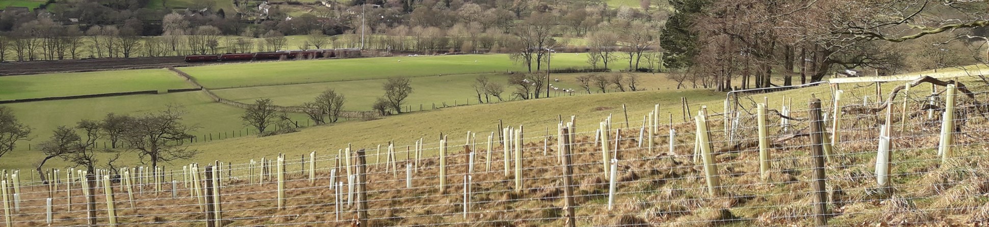
Against the international background of biodiversity loss and climate change, the government has set a series of ambitious targets for woodland creation across the UK. Under the Environment Improvement Plan 2023, in England the aim is to increase tree canopy and woodland cover from 14.5% to 16.5% by 2050. This is the UK’s first ever legally binding tree cover target and means that by 2050 England’s tree canopy and woodland cover will be at the highest levels in centuries.

Following the UK Forestry Standard (UKFS), which provides robust requirements and guidelines to support sustainable forest management, the Forestry Commission is very much committed to the concept of putting ‘the right tree in the right place’. That, however, is predicated on knowing where ‘the right place’ is!
The UK Forestry Standard makes it clear that heritage assets should be taken into consideration during woodland creation. Currently, there are robust and easily accessible online datasets relating to designated heritage assets. However, most historic environment bodies would acknowledge the limitations and accessibility issues present in the available online data relating to non-designated heritage assets. Datasets concerning these non-designated assets often vary greatly in their composition and detail and are not always readily sharable online due to their sensitivities, complex nature and, on occasion, technical challenges faced by their curators.
During 2020, the Forestry Commission and partner organisations (including Historic England) started to explore possible options for strategic approaches for considering the historic environment in landscape-scale woodland creation. Then in May 2021, DEFRA published the England Trees Action Plan (ETAP). Action 4.6 of the Plan aims to improve access to historic environment data to aid faster assessment of woodland creation proposals. To meet the objectives of Action 4.6, an options paper was produced in 2021 with input from Historic England, Natural England and the Association of Local Government Archaeological Officers. This paper resulted in three research projects (Projects A-C) being undertaken from late 2021 to early 2022. These explored options for improving existing access arrangements for information and advice on heritage assets, including historic landscapes, historic buildings and structures, and archaeological features.
Supporting research
- Two of the projects (Projects A and B), undertaken by Place Services, Essex County Council, assessed how Geographic Information System (GIS) datasets have been or might be used to produce maps that present historic environment sensitivities, historic environment opportunities and historic environment-led targeting for woodland creation, with a view to developing approaches that could be applied relatively quickly and cost-effectively across England.
- The third project (Project C), conducted by the Forestry Commission, explored the possibilities for Forestry Commission staff to directly access datasets held by local historic environment services using data feeds.
- A subsequent fourth project (Project D) was commissioned from ArchAI to explore the use of artificial intelligence to identify ridge and furrow earthworks from lidar imagery.
This research demonstrated the need for a comprehensive programme to address issues relating to access to and interpretation of heritage data to inform proposals for afforestation. Thus, in 2022 the National Historic Environment Datasets for Woodland Creation project was born. Using around £1.1M of funding provided by the government’s Nature for Climate Fund, it is a three-year initiative to create and develop digital datasets for use by both the forestry and heritage sectors to help safeguard the historic environment and enable a more efficient woodland design process, where heritage assets can be identified and considered in the earliest stages of proposal development.
To date, the project has identified three key approaches:
- Evolving the Selected Heritage Inventory for Natural England (SHINE) methodology so this dataset can be used to inform afforestation
- Creating a colour-coded ‘Heritage opportunity and targeting for woodland’ map by combining multiple historic environment datasets
- Enhancing the Forestry Commission’s existing land sensitivity to woodland creation mapping (available through the Forestry Commission Map Browser) by adding multiple historic environment datasets to boost the consideration and protection of heritage assets.
Using the Selected Heritage Inventory for Natural England for woodland creation
In 2008 the Association of Local Government Archaeological Officers (ALGAO), Natural England and Historic England produced the Selected Heritage Inventory for Natural England dataset. It is a simple dataset (without the complex detail of Historic Environment Record data) created by local historic environment services which enables land managers to identify key heritage assets for protection and management.
This single nationally consistent dataset, which includes selected non-designated heritage assets, is already in use for land management through Countryside Stewardship schemes, and it was, therefore, a stand-out candidate for inclusion in the project. The use of the Selected Heritage Inventory for Natural England in DEFRA’s new Environmental Land Management (ELM) scheme added to its appeal, as a significant proportion of the new woodland required by statutory targets will be delivered by the Forestry Commission’s flagship woodland creation initiative (England Woodland Creation Offer) which will be part of the ELM scheme from 2025.
As the potential to adapt the Selected Heritage Inventory SHINE dataset for use in woodland creation became clear, further research on how it could evolve was vital. So, in late 2022/early 2023, the Forestry Commission commissioned two further projects (Projects E and F).
Project E involved five local historic environment services (Bedford, Cambridgeshire, Cornwall, Gloucestershire and the South West Heritage Trust) creating new Selected Heritage Inventory for Natural England records, using the existing methodology and data standards but considering how they would need to change for use in woodland creation proposals.
Project F saw consultants undertake extensive stakeholder consultation with both the forestry and historic environment sector. This included a questionnaire, one-to-one interviews with users or creators of the Selected Heritage Inventory for Natural England, and workshops to discuss the potential for the dataset to evolve for use in woodland creation.
Following this work, an agreement on the nature and usage of the evolved Selected Heritage Inventory for Natural England dataset was reached in summer 2023, enabling a national roll-out to improve the comprehensiveness and coverage of this data across England from autumn 2023.
Using artificial intelligence
An evolved The Selected Heritage Inventory for Natural England dataset is only one of a suite of datasets being deployed by the National historic environment datasets for woodland creation project.
Two innovative datasets were procured from ArchAI to identify ridge and furrow earthworks (Project G) and areas of historic woodland (Project H).
Ridge and furrow is frequently encountered during forestry projects and is thus important to locate and characterise, while areas of lost historic woodland are often good locations in which to consider re-planting.
To produce these datasets, ArchAI pioneered the use of artificial intelligence and machine learning to interpret Environment Agency Lidar digital terrain model (DTM) data (for ridge and furrow) and 19th-20th century historic Ordnance Survey maps (for historic woodland) for the entirety of England.
This automated approach allowed comprehensive datasets to be built rapidly and to a high level of accuracy and precision.
Visual sensitivity mapping
Work on other historic environment datasets continues in-house at the Forestry Commission, aimed at demonstrating how the identification of ‘Zones of Theoretical Visibility’ would help in the consideration of views from and between designated heritage assets. Building on this concept, the aim is to produce visual sensitivity mapping to illustrate the impact woodland creation could have on one element of setting for heritage assets within proposal areas. Consideration of landscapes less suitable for woodland creation will also be needed and a dataset based on Historic Landscape Characterisation (HLC) data could help to identify historic landscape types that should be avoided when considering afforestation. Working in collaboration with partners will be key to ensuring these datasets are fit for purpose and can be used to guide appropriate woodland creation.
Finally, once all of these datasets have been developed, the project will blend them together to create the tools needed by the forestry sector – the targeting and opportunity map and sensitivity to woodland creation mapping. After all, if opportunities are highlighted and challenges and constraints are flagged early in the woodland creation process it is beneficial to all. While the project still has some way to go, the future relationship between trees and the historic environment is looking more harmonious.


Further information
-
Project A: Assessing the use of GIS to Map Zones of Woodland Creation Sensitivity Around Designated Heritage Assets
By Lloyd-Regan, M, Medlycott, M & Saunders H. 2022. Place Services Essex County Council, Chelmsford.
-
Medlycott, M. 2022, Project B: Assessing the use of GIS to produce woodland creation historic environment opportunity/targeting maps,
By Medlycott, M. 2022. Place Services Essex County Council, Chelmsford.
Download in PDF Format
You can download this article along with the others in this issue as a PDF magazine.


