NAIS Lowland Pilot: West Wiltshire
The project aimed to improve understanding and protection of the archaeology of the Avon vale in West Wiltshire. This lies between the better known historic landscapes of the Cotswolds to the west and the Wiltshire downs to the east.
This was the second in a suite of new projects designed to integrate aerial mapping with other techniques of archaeological investigation, in order to identify and protect the most significant sites and monuments. It finished in 2016.

Protecting Wiltshire’s heritage
The project area is topographically and geologically diverse, presenting challenges to the use of remote sensing techniques. Jurassic rocks, which are overlain by chalk further east, crop out in succession, while within the clay vale there are also areas of alluvium and gravel.
Previously known heritage assets range from the Neolithic long barrow at Lanhill to the World War II pillboxes that line the Kennet and Avon canal. Late prehistoric enclosures and medieval settlements occasionally survive as earthworks within woodland or areas of early enclosure. Of particular interest is the significant but poorly understood Roman settlement at Sandy Lane (Verlucio) and its surrounding landscape.
Possible threats to the archaeological resource in this area include the likelihood of future development along the A350 road corridor, especially around the historic towns of Chippenham, Melksham, Trowbridge and Bradford-on-Avon.
In rural areas, where the main land use at present is grazing livestock, there is a risk that economic changes could make the conversion of pasture to arable more likely in the future.
The results of the project will aid management of this landscape by enhancing the local Historic Environment Record (HER) and other databases, and by raising awareness of its archaeological potential.
Stage 1 - Aerial mapping
The first stage of the project comprised aerial investigation work undertaken to National Mapping Programme (NMP) standards. The archaeological landscape recorded during the aerial survey shows evidence for changing patterns of settlement and land division from the prehistoric period to the present.
Parts of the medieval and later landscape are fossilised in the current field pattern but there is considerable evidence of changes in land use seen in the extensive remains of ridge and furrow cultivation and earthworks of abandoned settlements.
There is also evidence of a pre-medieval pattern of settlement and land division, and examples of some of the earliest monuments (mainly Neolithic or Bronze Age burial mounds) are scattered throughout the project area.
Highlights from the aerial mapping include potential evidence of early medieval fields, extensive prehistoric fields between South Wraxall and Broughton Gifford, a range of later prehistoric or Roman settlement types and a complex multi-period landscape in the vicinity of the Roman small town at Sandy Lane.
These results were used to target ground-based work in order to further understand the development of the historic landscape.
Stage 2 - Fieldwork
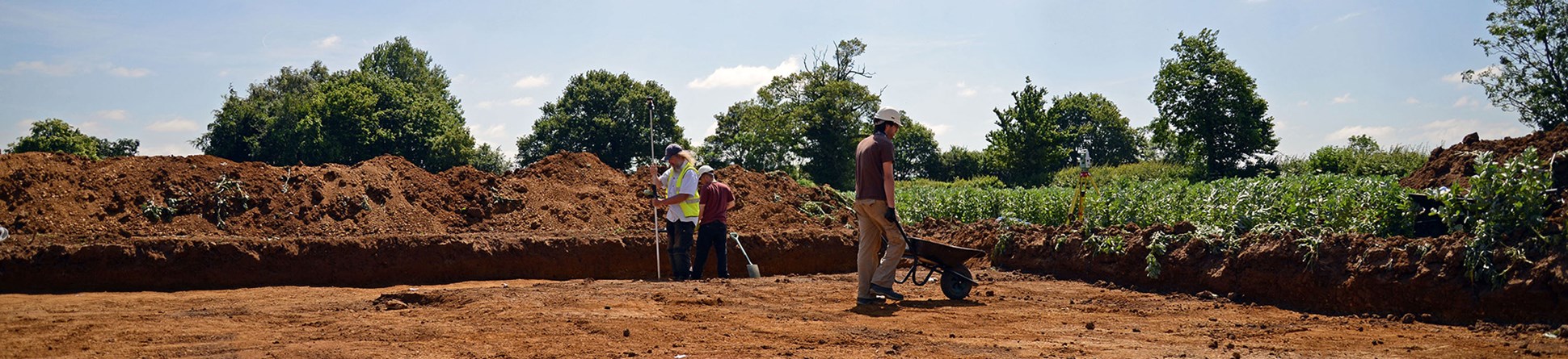
The ground-based fieldwork included earthwork survey, geophysical survey and excavation. As always, the choice of targets reflects a compromise between archaeological research objectives and pragmatic issues of access and cost.
An early decision was to exclude the complex Sandy Lane area and prepare a proposal for a separate project that could do justice to this landscape and its management issues.
Analytical earthwork survey covered a wide range of sites including medieval or earlier field systems around Gastard, settlement earthworks at Lower Paxcroft and various features at Great Chalfield.
The other techniques were used to investigate a group of cropmark enclosures (see below), while all three methods were applied to settlement earthworks at a farm near Lacock.
Iron Age and Roman enclosures
Geophysical survey and excavation were deployed in combination at two sites where Iron Age or Romano-British enclosures had been identified.
Excavations at Paxcroft near Trowbridge uncovered both Iron Age and Roman sites, one curvilinear in form and the other rectilinear. The second site was a rectilinear enclosure at Kellaways near Chippenham, which produced evidence of Romano-British occupation.
A third such enclosure with a distinctive straight 'driveway', shown in the aerial photograph above, was subject to geophysical survey only.
The history of a farmstead
Earthworks identified in paddocks at a farm near Lacock were surveyed and interpreted as a settlement with hollow-ways and possible house platforms.
One of the latter was chosen for excavation, which revealed a late 16th/early 17th century building with stone walls. Interestingly this dates to the same period as the surviving farmhouse, which is being studied by historic buildings experts.
Because of the presence of stone foundations, ground-penetrating radar (GPR) was then deployed by the geophysics team to see if other such buildings could be located within the settlement.
Reports
A full list of the separate reports from the project is provided below. These cover individual pieces of fieldwork, together with an integrated report on the overall project, looking at the development of the landscape over time and highlighting the main characteristics of the archaeological record in this area. All project data will also be added to the Wiltshire Historic Environment Record (HER).
- Catridge Farm Geophysical Survey
- Kellaways Geophysical Survey
- Little Chalfield Geophysical Survey
- Paxcroft Geophysical Surveys
- Great Chalfield Analytical Earthwork Survey
- Lower Paxcroft Analytical Earthwork Survey
- Catridge Farm, Lacock: The Remains of a Shrunken Settlement
- West Wiltshire NAIS Project Report
The images used on this page are copyright Historic England unless specified otherwise. For further details of any photographs or other images and for copies of these, or the plans and reports related to the project please contact the Historic England Archive.
For further information on a project or any other aspect of the work of the Historic Places Investigation Team please contact us via email using the link below.

Dr Jonathan Last
Dr Jonathan Last is an archaeologist specialising in prehistory. He has worked in various roles for English Heritage and Historic England since 2001. He is currently Landscape Strategy Adviser in the Archaeological Investigation team.
Also of interest


