The 'Gunnes' of Warship Hazardous Prize (1706)
Historical and archaeological research on a protected wreck site, focusing on the ship's cannons or 'gunnes'.
Historic England has been supporting the avocational team working to research, survey and document the protected site of Warship Hazardous Prize, which was wrecked in Bracklesham Bay, West Sussex, in 1706.
New underwater discoveries and archive research have greatly enhanced our knowledge of the wrecking process and armament of the vessel.

Background to the wreck
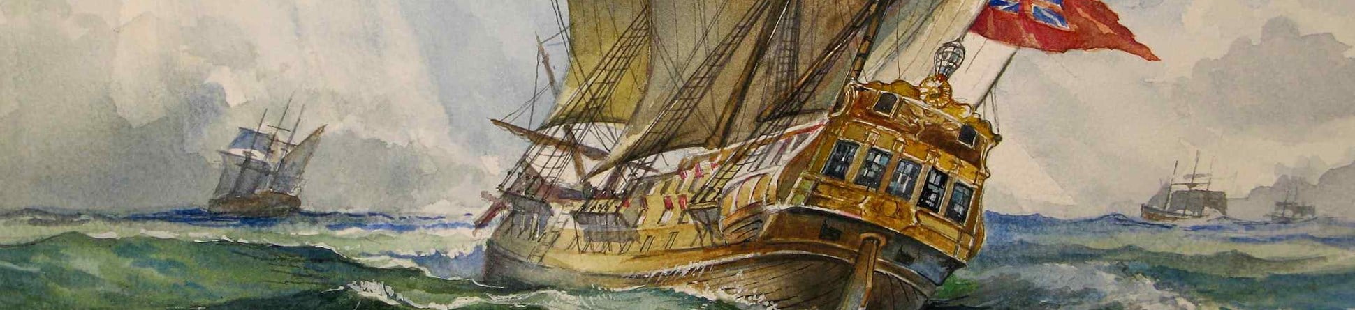
Warship Hazardous Prize began life as Le Hazardeux, built for the French Navy.
Its keel was laid down in the L’Orient shipyards in Brittany in 1699 and the vessel was commissioned into the French Navy as a 50- gun, Third Rate Ship of the Line in February 1701, carrying an initial complement of 22x 18 pounder, 22x 12 pounder and 6x 6 pounder guns.
In 1703 Le Hazardeux was captured by the Royal Navy and taken as a prize. After repair, Her Majesty’s Warship Hazardous Prize entered service in 1704 as a 54-gun, Fourth Rate with 24 x 18 pounder (Lower Deck), 24 x 12 pounders(Upper Deck) and 6 x 6 pounders(Half Deck) guns.
Larger than the average British Fourth rate, Hazardous was considered by Naval Surveyors and her Captain, Barrows Harris, to be capable of carrying 60 guns.
If her bottom proves as well as her upper Works are, that she will make a very good Sixty Gun Ship.
Harris petitioned the Admiralty for 6 more guns but was refused. He then requested two stern chasers - backwards facing guns or cannon at the stern used to fire on pursuing vessels. We have yet to find evidence that this request was granted.
On the morning of 19th November 1706 and in severe gales, in order to save lives, Hazardous was deliberately ran ashore in Bracklesham Bay, West Sussex at the end of a disastrous return from the Virginias as escort to a large merchant fleet. Within days, Hazardous settled and listed to port.
Contemporary salvage was attempted and the wreck was partially dismantled in January 1707. Archived Admiralty letters state that 21 guns (including possibly 6 bronze guns) were recovered before the wreck was abandoned as derelict.
The precise site of the wreck was unknown for over 250 years. In 1966, a spear fisherman came across a large iron gun in the Bay but saw no sign of other wreckage. This gun was raised, desalted in Chichester Canal and delivered to Cumberland House Museum in Southsea, though its fate is currently unknown. The Main Site was discovered by members of the 308 Branch Sub Aqua Association in 1977.
Four decades of archaeological research on Hazardous Prize
The site has been worked since discovery, first by 308 Branch and more recently by the Warship Hazardous Prize Project Group.
The site was designated under the Protection of Wrecks Act (1973) in 1986 and the current principal Licencee, Iain Grant, started diving the site in 1982.The main wreck site lies in 6-9 metres of water some 800 metres from the current shoreline just east of Bracklesham village and is being eroded by biological and physical processes.
The bay faces south west and is at the mercy of the dominant prevailing winds, wave action, tidal flow and shifting sand banks.
Site conditions place significant constraints on the archaeological process, underwater visibility is often less than a metre and diving is often cancelled at short notice because of visibility or safety concerns: wind and waves make launching, recovery and operating from a large rigid inflatable boat unsafe.
A site plan prepared in 1991 showed 2 large areas of articulated timber and 13 large guns, some partly buried, some still on their carriages.
Winter storms, particularly in 1990, destroyed the entire southern area of articulated timbers. However, the shifting sands regularly expose a diverse range of small artefacts, which are recovered under licence, conserved and recorded. The project has documented both the remains on the seabed as they have become exposed over the decades and the ever changing seabed levels. As a consequence, the site has featured on the Heritage at Risk Register on several occasions.
Historic England has supported the project group in various ways over the years. In 2015, it awarded funding for small-scale test excavations within the main site to assess the remaining artefact load.
Circumstances since 2015 have been difficult. Weather conditions over the last few years have prevented all but a very few days of excavation, and furthermore several team members have been away contributing to two major maritime projects Invincible (1758) and Rooswijk (1740): the team has, therefore, had to adapt activities according to weather and resources. It has, however, achieved a huge amount in the limited windows available to dive the site. Chance findings and recent technological advances (especially the application of photogrammetry) have shifted recent attention to the ship’s guns.
Main Site
In 1986, two of the thirteen guns on the main site (“D” and “I”) were raised, de-concreted, and recorded. Gun “I” had unusual rings forward of the trunnions (the projecting mounting and pivoting points at each side) but ordnance experts were unable to positively identify the country of origin or maker. At the time, guns from Prize vessels were re-used so an English Naval vessel could be armed with guns originating from more than one country.
Portsmouth Museum Service attempted electrolytic conservation of these guns - using electric current to remove corrosive salts from the metal in order to stabilise it- but without success.
New discoveries made in 2014
In 2014, Historic England commissioned Wessex Archaeology to undertake a sidescan sonar survey of the area around the Main Site. This technique involves using acoustic signals pointing sideways and down from a vessel or towed unit to map the detailed topology of the seabed and any structures on it).
This identified several linear features in a cluster some 130 metres to the west-south-west. Since the seabed in the area naturally erodes into narrow linear ridges, any anomalies were investigated by diving to check if they were really made by human activity. A cluster of 11 large guns and a significant quantity of round and bar shot were located. Although basic measurements were taken at the time, project activity remained focused on the Main Site.
In the last couple of years, there have been a few days when visibility in the Bay improved enough to justify site recording by photogrammetry.
One such occasion allowed us to revisit and record the 2014 Gun Site. This involved swimming over the entire site with a GoProTM camera in underwater housing and powerful underwater LED video lights, continuously taking video footage of small areas from different distances and angles. Individual frames were then extracted from the video, one from every few seconds, and entered into software which pattern-matches between them to calculate relative camera positions and thus build up a full 3D model of the area. If done with care, it can generate photo-realistic, sub-centimetre accuracy surveys across large areas of which only a very small part is visible at any one time. This technique is ideal for underwater sites in UK waters, where visibility is a major issue, and represents a massive saving of time over tape-measure surveys.
'Pete’s Gun'
In 2008, a single gun (‘Pete’s Gun’) was located some 85 metres north-west of the Main Site by team member Pete Jolly. Its position was marked by GPS but no further recording was undertaken at the time. In 2019, we went to check if the gun was still exposed. It was relocated and later recorded by photogrammetry.
Further discoveries in 2019
In 2019, on the dive to relocate 'Pete’s gun', team members then reeled off from the anchor line to explore the surrounding area and purely by chance came across a further cluster of 9 large guns, round and bar shot, a small anchor, a cooking pot, sounding weight and other artefacts some 110 metres from the Main Site. A few weeks later, a tenth gun was revealed, emerging from an eroding sandbank some 10 metres distant and there may yet be more to find. Again, photogrammetry has enabled the rapid surveying of a large area.
Site distribution and the wrecking process
We now have three discrete clusters of guns plus 'Pete’s gun' within 150 metres of each other on the seabed. Only 2 other Naval vessels are known to have been wrecked in the Bay, both lost in the Great Storm of 1703.
One was a small, 10-gun advice vessel the Eagle, the other, a 50 gun fourth rate, HMS Newcastle was reported to have been lost much further east. Therefore we conclude that all these guns are from Hazardous.
These sites are revising our understanding of the wrecking event. Sounding leads, used to measure water depth, have been recovered from both the 2014 and the 2019 Gun Sites suggesting that attempts were being made to calculate when the ship would ground.
The Sailing Master’s log survives in the National Archives and simply states “ashore in Bracklesham Bay”, so we have no historical evidence of deliberate jettisoning of guns to lighten the ship in an attempt to get closer to shore.
Each gun weighs several tonnes, so losing the weight of multiple guns in a grounding and listing event, plus the evacuation of some 350 men, would significantly lighten the vessel, allowing it to refloat on a subsequent tide and move several times before it finally lodged where the main site is today.
Gunnery equipment
A range of gunnery-related artefacts have been recovered from the site including gun-carriage axles and wheels, rammers and mops, lead aprons and cartridge cases. When first located, some of the guns on the Main Site sat on well-preserved gun carriages, but these have since largely been eaten away by gribble, a type of burrowing crustacean.
Doing the maths
As far as we have been able to determine from archive research, at the time of its sinking Hazardous carried a complement of 54 guns (possibly 56 if Harris’s request for 2 stern chasers had been granted) and contemporary salvage recovered 21 guns (though the 6 bronze guns mentioned in the contemporary salvage archives remain a mystery as we have found no proof that Hazardous was carrying any).
Those 21, along with the 1966 recovery (1 gun - assumed Hazardous), the Main Site guns (13), 'Pete’s gun' (1), the 2014 Site guns (11) and the 2019 Site guns (10 guns and possibly counting) = 57 guns. Although all of the guns are iron and heavily concreated, none appears to obviously have had its trunnions removed (as, we understand, would have been the case if old guns were recycled as ballast).
We therefore appear to have rather too many guns!
Success despite the British weather
The project is a prime example of the contribution that avocational teams make to our maritime heritage.
As with much British diving, and many archaeological projects, things rarely go exactly to plan.
Despite the problems caused by the weather over several seasons, important new historical and archaeological progress has been made and the project moves on, documenting and disseminating.
One day, we will be able to finish that excavation, though with coronavirus at large, it probably will not be in 2020!
This article is dedicated to the memory of team member Peter Jolly, one of the original 308 team members, who sadly passed away earlier this year.
About the author

Dave Johnston
Avocational diver and underwater archaeologist, Warship Hazardous Prize (1706) Project Group.
Dave is a professional biologist with a day job running microscopes in the Biomedical Imaging Unit at the University of Southampton. He is one of the many avocational underwater archaeologists who devote their time, energy and finances to research, survey and document the Nation’s protected wrecks. He joined the Hazardous Project Group in 2002 (a newcomer!) and his dive log for his first dive on the site records “Visibility very poor, lots of crabs, lobsters and small fish. Couldn’t really get any impression of the site (or even that it was a wreck site!)”. You can find more about his work at the Hazardous project website.
Further information
Owen, NC, (1991) ‘Hazardous 1990-1991 interim report’ The International Journal of Nautical Archaeology 20.4: 325-334
Captain Barrows Harris’ letter: PRO 285 Letter dated 24 Dec 1704 Reference: ADM 106/586/285 Folio 285: Captain Barrows Harris, the Hazardous, Hamoaze.
Download PDF magazine
You can download this article in PDF format as part of Historic England Research magazine Issue 16.

Also of interest


