National Marine Heritage Record
In line with HIAS Principle 2 ("Historic England should be the first point of call for and primary trusted source of national datasets, such as the National Heritage List for England and national marine heritage dataset"), we are currently developing a new database system to accommodate the National Marine Heritage Record (NMHR). Once development is completed, this system will provide a publicly accessible online portal through which users can search for and view marine heritage records.
Alongside the work noted above, as of September 2024, the Marine Historic Environment Record Service for England (MHERSE) has been established to maintain, enhance and facilitate access to, and interpretation of, the NMHR.
They can be contacted at:
Email: MHERSE@historicengland.org.uk
Phone: 01793 445100
The dataset will inform responses to marine planning and contribute to assessments of significance for heritage assets under consideration for statutory protection. Researchers may also consult it for thematic studies to inform conservation.
Building on Historic England’s existing marine data, the NMHR will contain information relating to heritage assets that lie between Mean High Water and the 200 nautical mile sea limit, as well as the tidal extent (at Mean High Water spring tides) of rivers, estuaries and creeks – i.e. the operational extent in England of the Marine Management Organisation’s (MMO) inshore and offshore remits as laid out under the terms of the 2009 Marine and Coastal Access Act.
Historic England will work with partners, such as with Local Planning Authorities, to future proof as much as is feasible. Historic England will also work with other national partners, especially the Marine Management Organisation (MMO) and the UK Hydrographic Office (UKHO), to hold all appropriate heritage data on the English Offshore (12-200 nautical mile) area, and to build enhanced bilateral data-flows with such organisations.

Offshore Data, Online Access
The online portal will allow users to search the NMHR spatially via a map interface, as well as build complex textual and conceptual queries. Through the Marine HER Service for England, users will be able to make enquiries, request exports of data and/or the creation and enhancement of records, and interpret and contextualise NMHR data using datasets from key partners both external and internal to Historic England, including the MMO, UKHO and the British Geological Survey
Users can currently access marine records via the Heritage Gateway under the subheading Non-Statutory National Data Historic England research records. A future development milestone for the new NMHR system include direct integration into the improved Heritage Gateway.
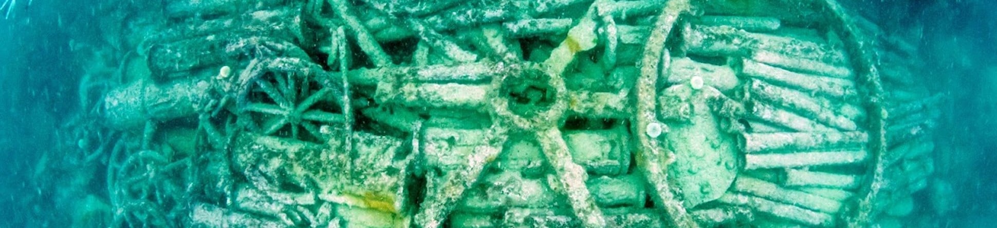
The current NMHR dataset includes 37,000 shipwrecks, including approximately 6,000 wreck sites where physical remains have been identified on the seabed. The remaining 31,000 wrecks are known only from documentary sources, including historic newspapers as well as authoritative secondary sources such as Richard and Bridget Larn’s Shipwreck Index of the British Isles. In addition to shipwrecks, there is also information on approximately 7,500 unidentified seabed obstructions, approximately 1,000 isolated findspots, as well as activities, people, organisations and bibliographic sources.
The Marine HER Service for England will manage the continuing development and evolution of the NMHR to incorporate multiple flowlines of information from both internal and external partners, including the results of thematic research projects, commercial fieldwork added through the OASIS platform, chance finds reported through industry-specific protocols, and projects delivered in partnership with key external partners, such as the Marine Data Exchange Heritage Accelerator supported by the Crown Estate.
Our records are also accessible as part of the aggregated national dataset compiled by the Unpath’d Waters project as a shared and cross-searchable online catalogue of marine data across the UK. This catalogue is now freely and openly available via the Unpath’d Waters Portal.
Also of interest


